high-precision-positioning high-precision-positioning

High-precision Positioning Service

As industries are seeking for finer development, the demands for higher-precision positioning has become increasingly widespread. Based on BeiDou navigation satellite system, compatible with GPS, GLONASS, Galileo and QZSS, and relying on the core equipment and data analysis and computing platform developed in-house, we have set up BeiDou ground-based augmentation system to realize “One Network Nationwide”, and formed high-precision positioning infrastructure, so that we can provide users with the highly reliable, highly stable and expandable positioning service of high-performance and high-precision. We also work with industry partners to empower autonomous driving and IoT industry to usher in the era of Internet of Everything (IoE).

Advantages

Centimeter-level Precision

Centimeter-level Precision

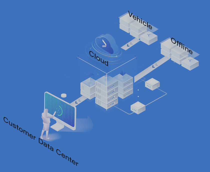
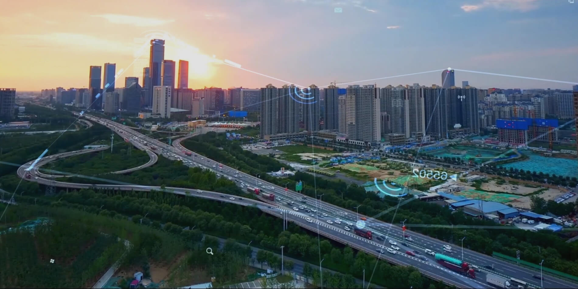
Based on the RTK technology, in combination with the PPP technology, and by means of the ground-based augmentation network and data analysis & computing platform, we can calculate the correction information of various errors and broadcast them to the terminal equipment in real time for high-precision positioning

Nationwide

Nationwide

Joining hands with partners and based on about 3000 continuously operating reference stations, we provide users with differentiated high-precision positioning services through “One Network Nationwide”

Industry Application

Industry Application

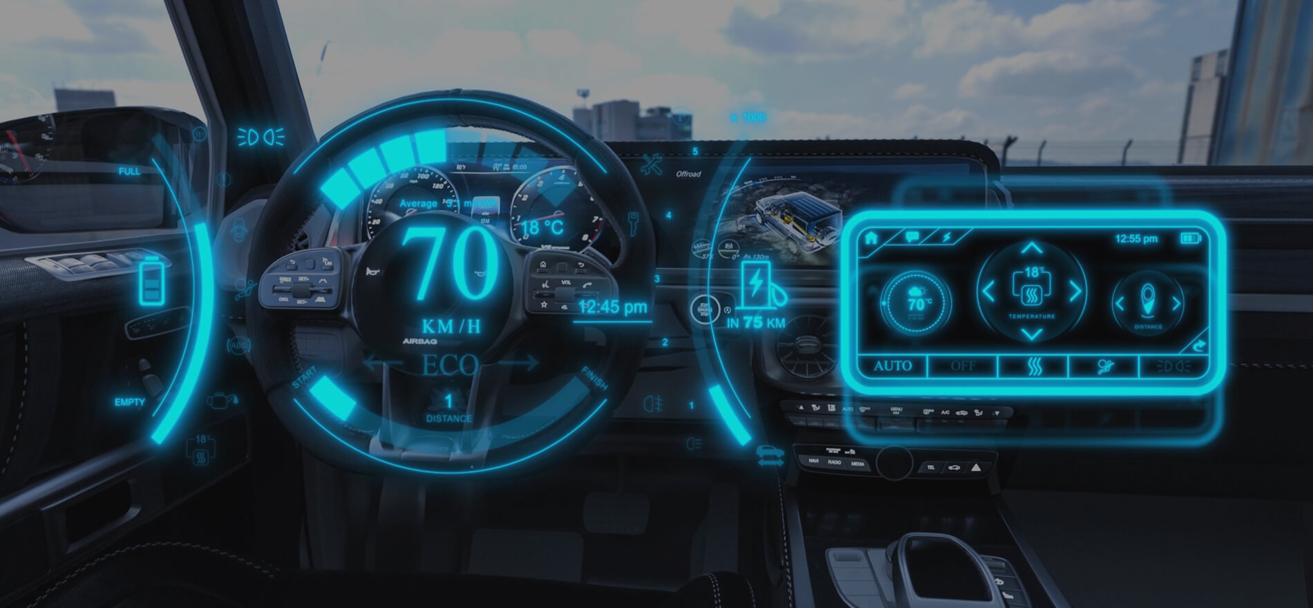
We provide software-hardware integrated solutions to create first-class experience for customers. We also provide high-precision positioning products and services for such fields as intelligent driving, V2X, smart traffic, smart city, precision agriculture, deformation monitoring, power-line inspection, mass application and IoT

high-precision-positioning

Centimeter-level High-precision Positioning Service

Based on the NRTK technology, supporting 5 global satellite systems and 16 frequencies as well as end-to-end encryption, it can empower more industries such as intelligent driving, smart city, IoT, measurement, surveying & mapping, precision agriculture, consumer electronics, and outdoor robot, providing stable service with availability up to 99.9% for 100 million users of the above-mentioned industries.

high-precision-positioning

Sub-meter Level High-precision Positioning Service

Based on the NRTK technology, supporting 5 global satellite systems and 16 frequencies as well as end-to-end encryption, it can empower more industries such as smart city, IoT, measurement, consumer electronics, and outdoor robot, providing stable services featured by low cost, low power consumption, availability and high precision to 100 million users of the above-mentioned industries.

high-precision-positioning

High-precision Positioning Engine

We provide users with low-cost in-vehicle MEMS inertia - satellite integrated navigation positioning products and solutions to meet the requirement of vehicles for continuous, precise positioning in the real-world complicated environment. The integrated navigation algorithm can provide precise, continuous and smooth positioning results in outdoor environments where satellite signals are severely obstructed; and can output positioning continuously in environments where satellite signals are weak or missing, such as city gorge, avenue, overpass, tunnel, and underground garage. It has a strong capability of anti-obstacle and anti-interference from multi-path, in addition to a certain positioning precision.

Industry Applications

high-precision-positioning
Intelligent Driving

Intelligent Driving

Intelligent Driving

It can provide high-precision differentiated positioning services for intelligent driving at L2.5 and above.

Bike-sharing

Bike-sharing

Bike-sharing

With the high-precision positioning technology, we can acquire high-precision position information of bikes in real time so as to ensure efficient operation, maintenance and comprehensive management.

Precision Agriculture

Precision Agriculture

Precision Agriculture

It can provide high-precision positioning services for the whole cycle of crops including farming, sowing, manuring, spraying, harvesting and transportation.

V2X

V2X

V2X

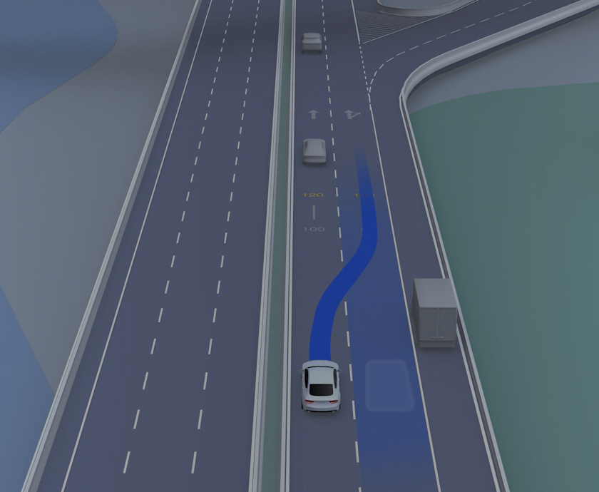
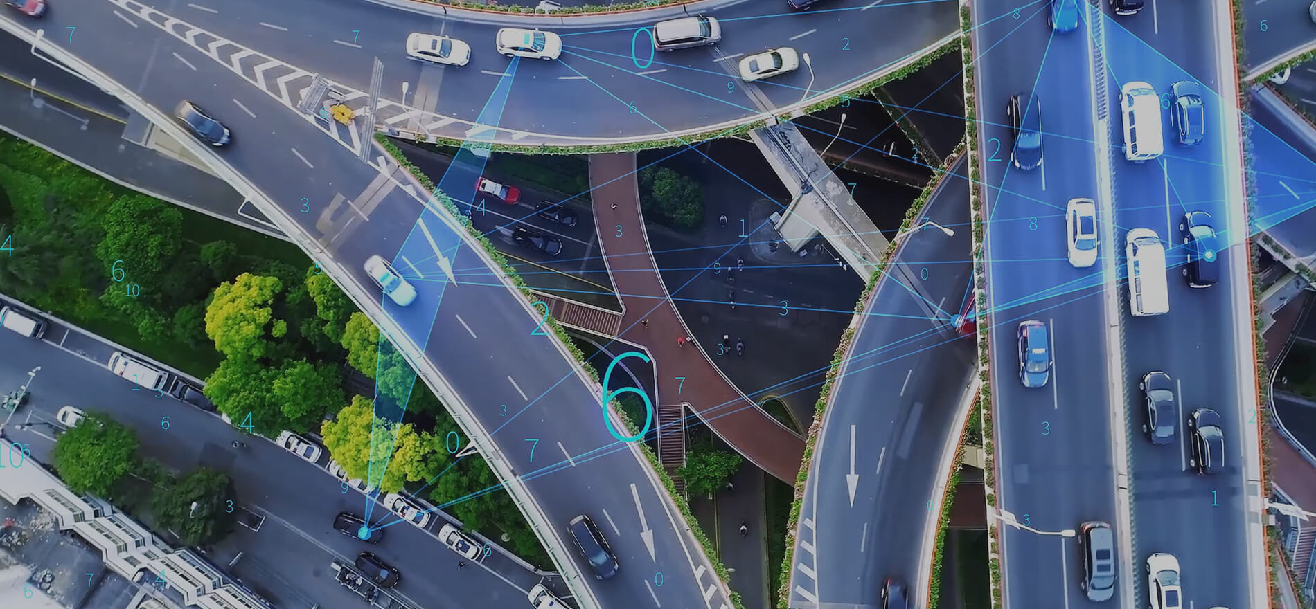
It can provide precise vehicle and infrastructure positioning to boost the application of V2X technologies in multiple scenarios, such as collision warning, left turning assist, and lane deviation warning.

Vehicle Monitoring

Vehicle Monitoring

Vehicle Monitoring

It can support vehicle location monitoring, lane-level monitoring of dangerous goods transport vehicles and parking / navigation services to improve vehicle management level.

Deformation Monitoring

Deformation Monitoring

Deformation Monitoring

It can support deformation monitoring on natural environments and artificial structures, as well as real-time positioning and navigation, ground calibration and trajectory playback services for drones, remote sensing, telemetering and other applications.

Mass Application

Mass Application

Mass Application

We can also provide high-precision positioning SDK and high-precision positioning correction services for smartphones and wearables like smart bracelet.

Smart Port

Smart Port

Smart Port

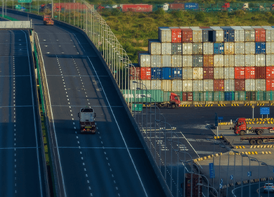
We can provide precise location services for port vehicle positioning, cargo handling, driving in formation, and positioning of personnel and valuable goods.

Online Ride-hailing

Online Ride-hailing

Online Ride-hailing

Based on the management platform, it enables supervision features including precise positioning, trajectory backtracking and alarm reminder to improve the efficiency of operation and management for online ride-hailing.