Digital Twin World

Physical World

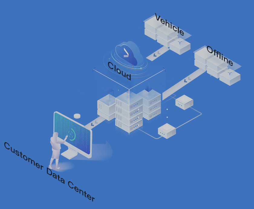
We can reproduce the physical world precisely by using various types of highly fresh geographic information data and PB-level multi-source business data deeply

As a 2D and 3D engine which is completely developed in-house, it is fit for geographic information system platform construction, and supports 3D visualization and real-time high-performance rendering

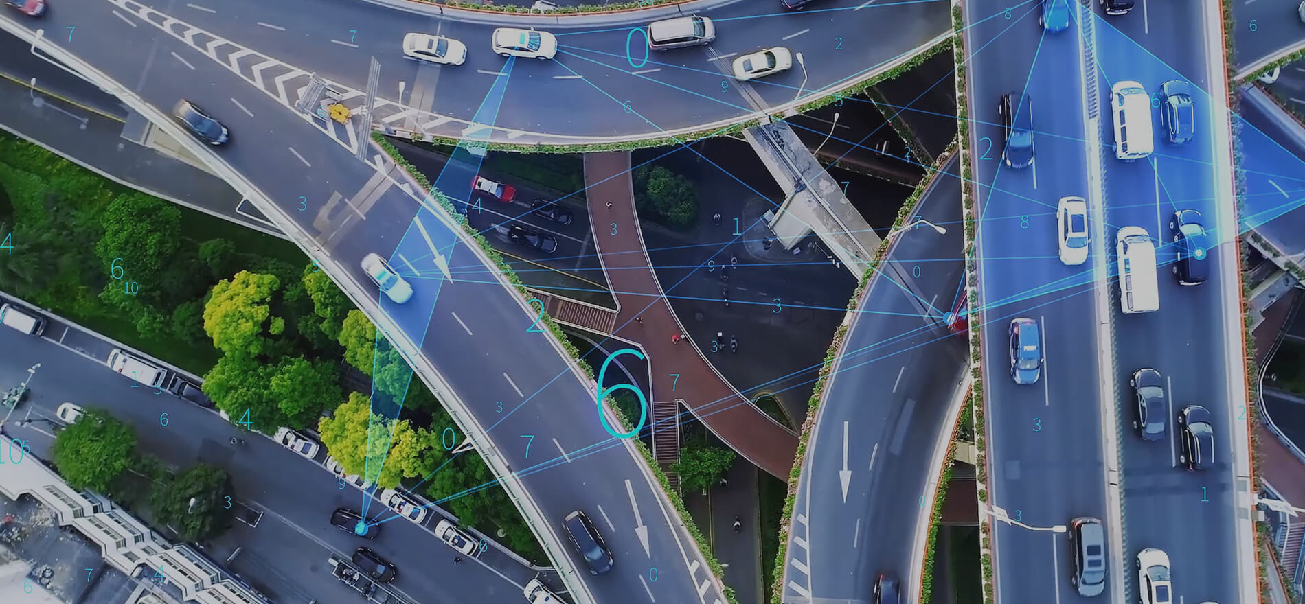
It supports second-level special effects of gigantic dynamic data, acceleration of innovative 3D hierarchical modeling service, and GIS+ video fusion perception
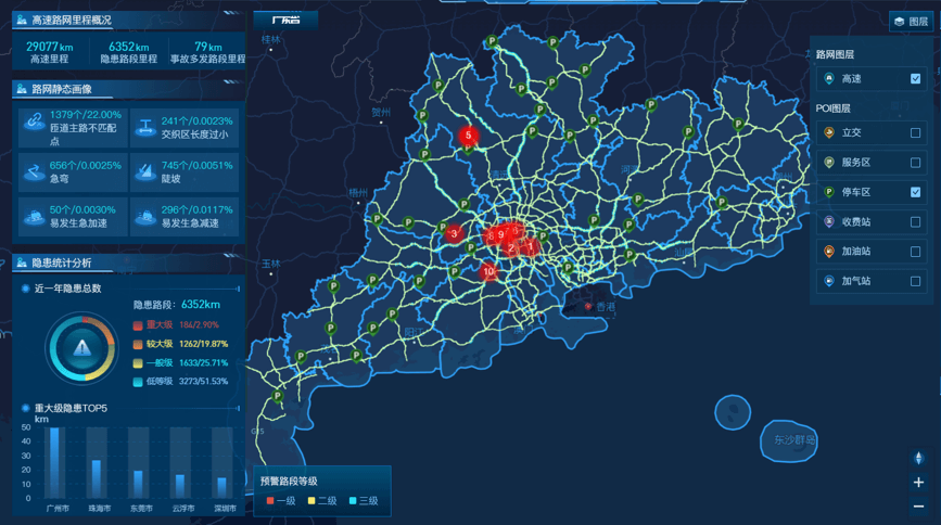
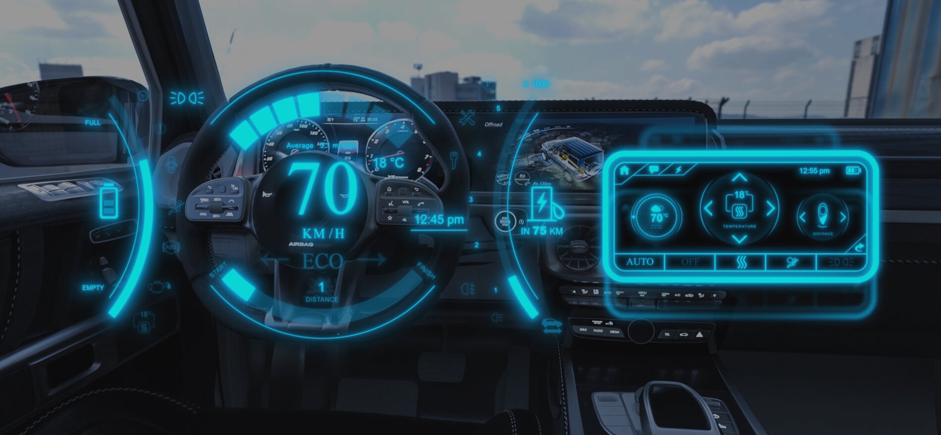
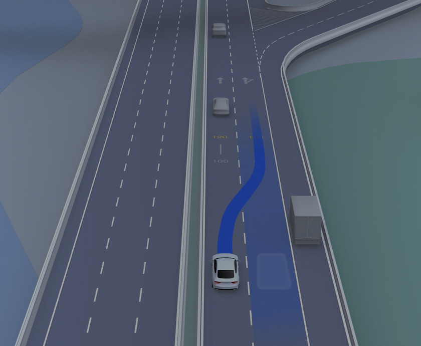
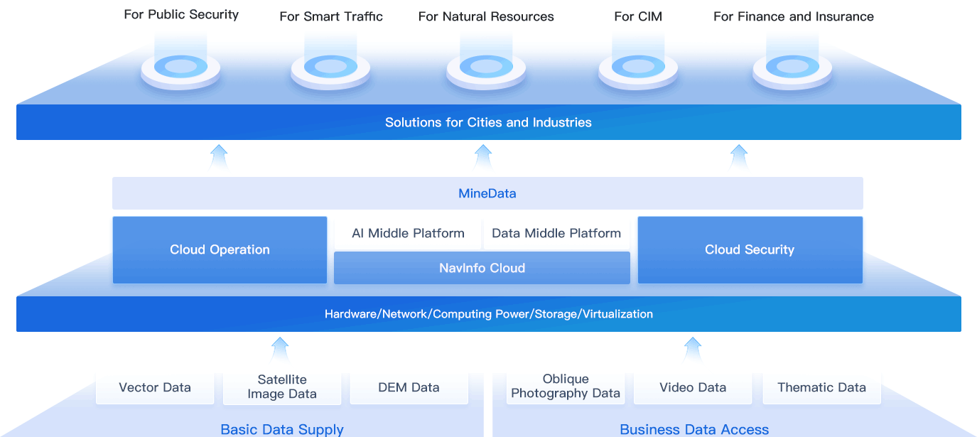
Based on the data and engine, and with vehicle-city collaborative development as the direction, we build three industry application platforms - “comprehensive smart traffic control platform”, “comprehensive digital traffic monitoring & regulation service platform” and “intelligent connected operation monitoring & regulation service platform” , and provide digital, refined solutions for innovative business fields like smart transport management, smart traffic control, intelligent connected vehicles & devices management and “traffic+”, so as to boost upgrading of smart traffic industry comprehensively.
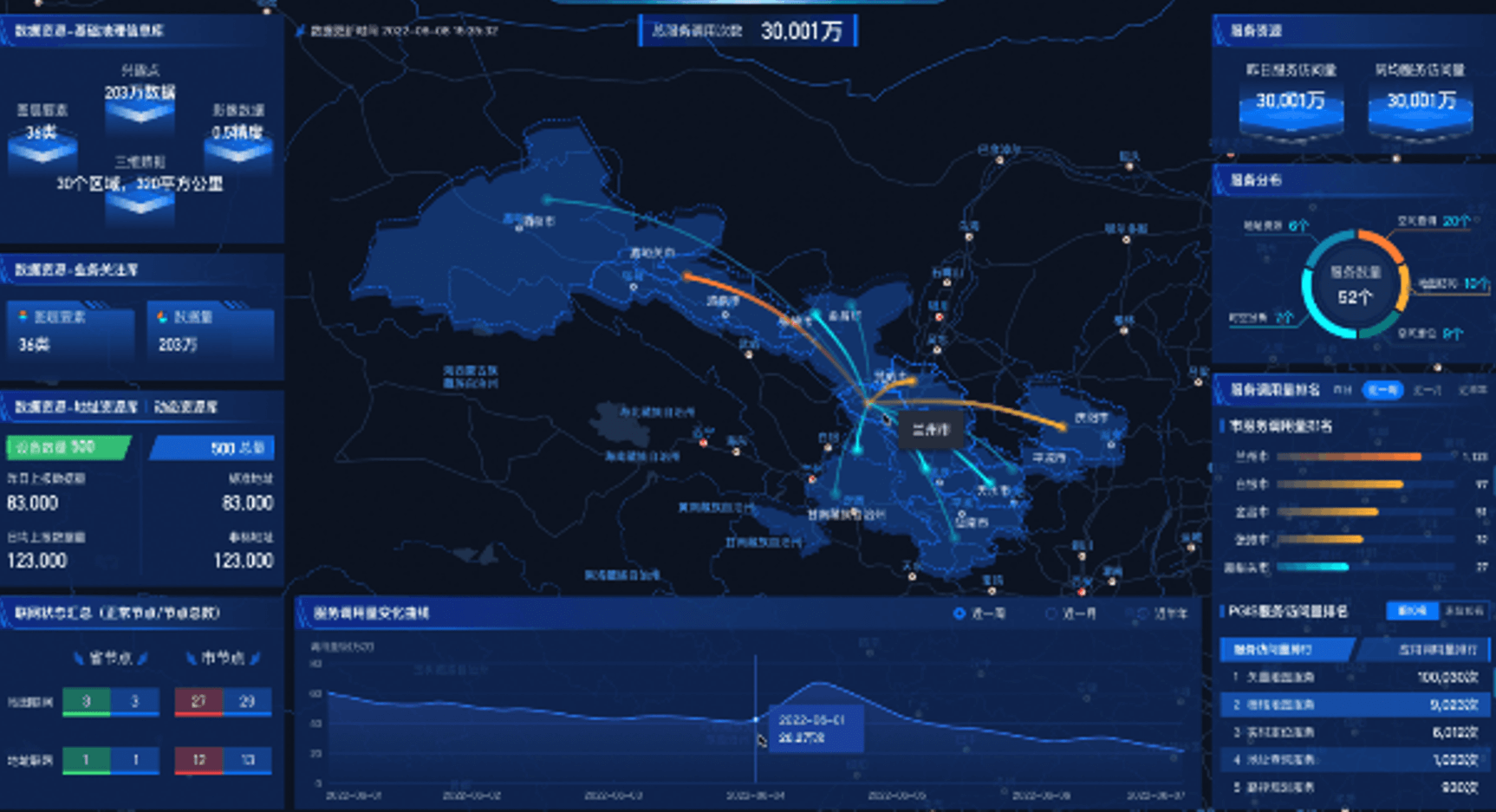
Based on the criteria of public security big data and PGIS, we provide spatial-temporal information system products for public security, which can empower the application in such scenarios as the management & control of aggregation in standard addresses, electronic sand table drill, geographic information mining. Our products can also be used in such scenarios as large-scale event security and the response to police alarm & emergency with the form of “data + platforms + solutions”, which can break the isolation of the data from various business departments, and realize unified commanding, collaboration of multiple levels, as well as quick response so as to improve the practical application level of the police.
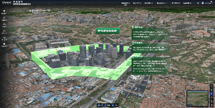
Based on the perception infrastructure of digital twin cities, we integrate the urban underground, above-ground, indoor, outdoor, historical, current, future, multi-dimension spatial data and IoT sensing data to build a complex of urban information with high- organization and interrelationship in 3D digital space. We also support 2D and 3D scenario building of terrain level, city level and parts level to enable digital twin cities with virtual-reality interaction; supporting digital transformation of governments, operators, insurance and financial fields to boost smart city management.
 Email:info@navinfo.com