

Learn more

It covers nationwide road network data and POIs, and supports functions like retrieval, display and routing in basic navigation scenarios. Based on the fundamental database with comprehensive elements, we provide customized navigation map services to meet the differentiated needs from different industries and customers.

Learn more
As the electronic map with centimeter-level precision dedicated to autonomous driving scenarios and serving autonomous driving systems, it can express fine characteristic elements, such as roads, lanes, road-side facilities and ground signs more precisely and elaborately.

Learn more
It includes road shape, topology, and other advanced attribute data, such as slope, curvature, heading and CLM. As a kind of vehicle “sensor”, it enables L2 driving assist functions such as adaptive cruise control, curve alert, adaptive headlights, intelligent suspension control and fuel efficiency improvement.

Learn more
It contains rich indoor and outdoor parking information, supports functions like parking space guidance, reverse vehicle tracking, and parking layout inquiry for drivers; supports valet parking solutions based on multiple positioning methods for smart vehicles; and supports smart parking lot operation and management.

Targeting enclosed road scenarios, HD Pro is a centimeter-level electronic map supporting L3 autonomous driving, covering 440,000km national highways and urban expressways.
Targeting urban open road scenarios, HD Lite is a meter-level electronic map supporting L2+ ADAS, covering 120+ Chinese cities and 300,000+km urban structural roads, provincial roads and national roads.
Self-owned data ingestion vehicles developed in-house to ensure data precision
Building data crowd-sourcing ecosystem to ensure data freshness
Processing data rapidly with the tool chain developed in-house to enable rapid imaging
Building mature integrated business systems to ensure data quality
Based on the landmarks of positioning map layer, current vehicle location can be calculated accurately by matching with the sensing results and calculating the distance, which is redundant with the high-precision positioning results obtained from other technical approaches to ensure the vehicle is aware of its own position all the time.
HD maps provide information like precise road surface domain and surrounding facilities, and mark objects like sidewalks as areas of interest. As the objects in the areas of interest might influence the driving behavior of the autonomous driving system, it’s necessary that the autonomous driving vehicle uses precise model to detect the objects in the areas of interest, and calculate such information as type, speed and posture of each object.
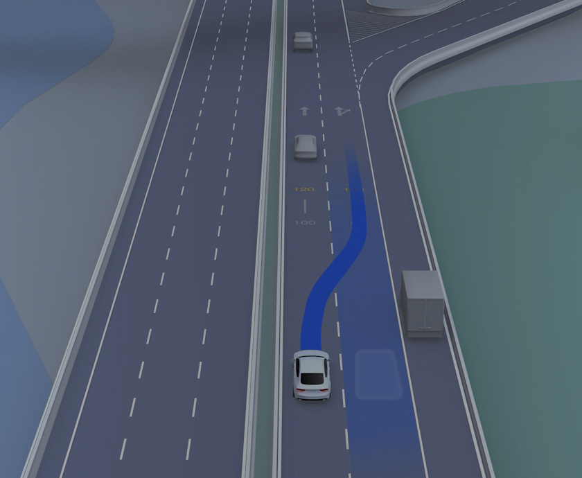
Lane-level route planning and local route planning are major applications of HD maps. The global route planning result from starting point to the destination is synchronized to the autonomous driving system, matching with HD maps and referring to the result to achieve lane-level route planning, the result of which is smooth, safe local route planning.
HD maps accurately record the correlations between lanes, such as the passing rules and traffic rules. In autonomous driving scenarios like complicated crossings with flows of vehicles and pedestrians, they can help the vehicle significantly improve the precision of prediction about the behavior of every road-rights competitors to make optimal decisions.
 Email:info@navinfo.com